I have always dreamed about big journeys and adventures. I have been always amazed by ship navigators, long haul truck drivers and everyone else who go far. I have watched and read the “Long Way Round” and all other Charley Boorman’s adventures countless times, I could not stop reading the amazing book “Long Ride Home” and many travel and overlanding stories and blogs. I have always dreamed to go on a big trip.
The life has given me a chance to move to one of Canada’s most amazing cities – Vancouver, I could not resist to drive there all the way!
Preparation
The distance between Montreal and Vancouver along Trans Canada Highway is about 4,500 km. It goes through 6 provinces of Canada, offering many interesting places and landscapes, from remote forest areas of northern Quebec and Ontario to endless prairies of Manitoba and Saskatchewan, to Rocky Mountains of Alberta and British Columbia. I could not miss this chance to see and experience this big part of Canada.
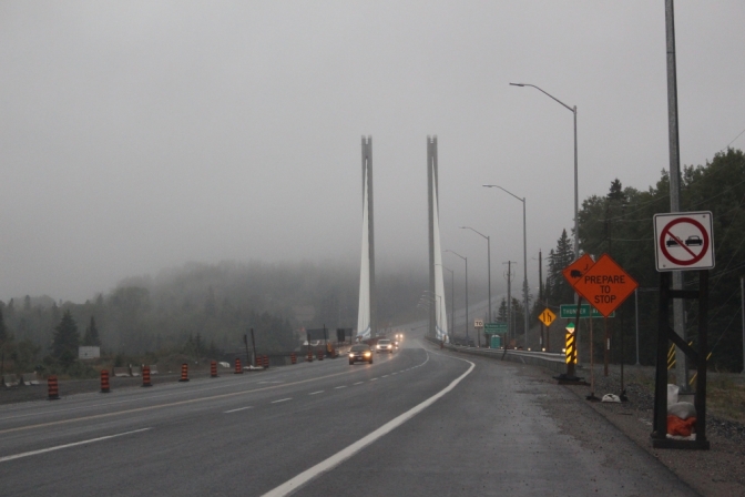
Actually, the Trans Canada Highway is not a single road, like Interstate 40 in the US or Stuart Highway in Australia. It is rather a set of roads that constitutes a road network that crosses Canada east to west. In the western Canada, both Yellowhead Highway and the main Trans Canada route, are both the part of Trans-Canada Highway. In Quebec and Ontario, the Trans-Canada Highway consists of two routes, the northern, via Hearst, Ont., Rouyn-Noranda, QC, and the southern, along the coast of Lake Superior and to Ottawa. Both eastern and western parts meet in Thunder Bay and Nipigon, Ontario, which creates a bottleneck in a highway system. The Nipigon River Bridge is the most critical section of the whole route. Last January the bridge was damaged and closed because of a winter storm, making it impossible to drive between eastern and western Canada, as there is no other road that crosses the river. The travelers were forced to wait for several days for bridge repairs or drive via USA.
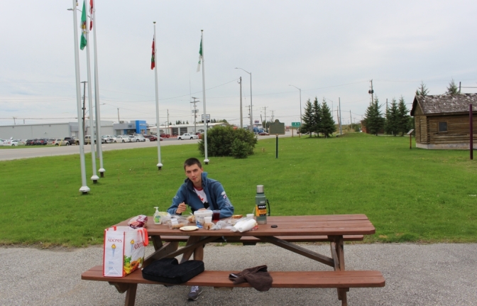
I sent most of my stuff into cross-country journey in a truck, packing my car only with most necessary stuff for the first month of living in Vancouver. I had no idea that it was possible to fit so much stuff into a small Hyundai! Four big bags with clothes, desktop computer case, 25 inch monitor in a box, plus seven smaller boxes with stuff, food cooler and bag with travel food! The trunk was full and rear seats area was filled almost up to windows level. The rear part was sitting quite low because of all that load, but still well above suspension travel limit.
It was a bit sad to leave Montreal that has became my first home in Canada, but we should always look for what lies ahead of us, right? And let go the past that becomes history with every minute.
Day 1. Montreal – Kirkland Lake, 720 km.
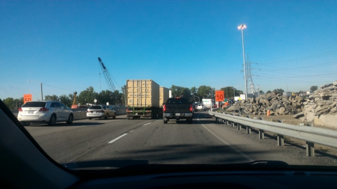
I left on Thursday at about 9 am, leaving several hours in the morning to finish last-minute arrangements. The traffic was horrible, it took me about an hour to get to Laval on Montreal’s north shore. But as soon as all traffic was left behind and the engine could breathe freely and accelerate me to usual 100 km/h, the real journey began.
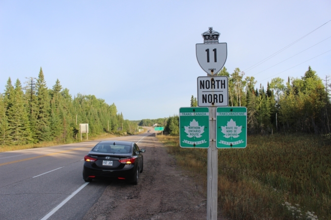
I decided to take a northern route in Quebec and Ontario. I got some suggestions that the route via Ottawa and lakes is more beautiful, but somewhat longer and slower. In addition to wanting to save some time, I was really curious to see more remote and wild areas of Canada that northern route traverses.
First, there was a very familiar section to Mont-Tremblant. But then, after I passed the last exit, there was a completely new and unknown land. 4,400 km of unknown. 4,400 km of discovering Canada.
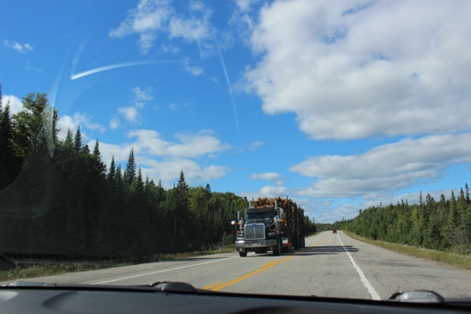
After passing Mont-Tremblant, the road continues through mountainous terrain, with many hills and lakes, some farms and small villages. It is a true land of log truckers! countless trucks haul huge piles of wood that looked scary even to a trucking fan.
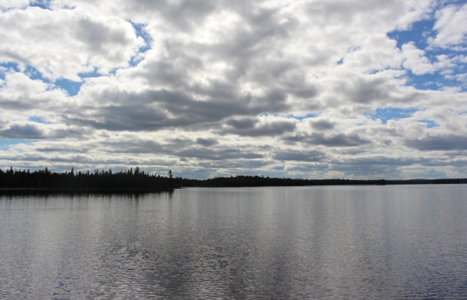
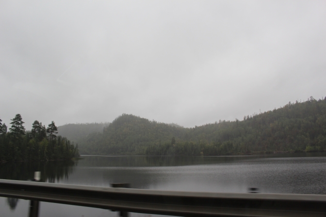
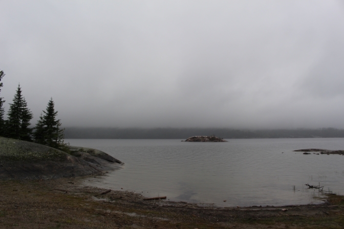
After the mountains, the road goes through some of the biggest and most beautiful lakes I have ever seen! Sometimes it feels that you are going through some sort of a swampland, but you know, a cool northern swampland, with pine trees and northern feel to it. In addition to small swampy lakes, there were many huge beautiful ones you can usually see on Discovery Channel or on some crazy nature photography website.
My friends warned me that that area is quite dangerous for wild animals, but luckily, I have seen no bears or wolves or deers.
My first fuel stop was at the city of Val d’Or. It was established for mining gold and mining is still the main industry in town, and it feels that was – rough, tough and rugged. Huge slagheaps, open-pit mines with huge dump trucks and excavators.
An hour later – a city of Rouyn-Noranda, a capital of the Abitibi-Témiscamingue region of Quebec. Being also a mining town, it looks and feels somewhat different, more like administrative center.
After passing Rouyn-Noranda and turning due west on Highway 117, the traffic died down completely and it was an amazing ride through desolate forest in a beautiful sunset. The sun was coloring trees and lakes in most unique colors, giving it a somewhat sinister and attractive appearance.
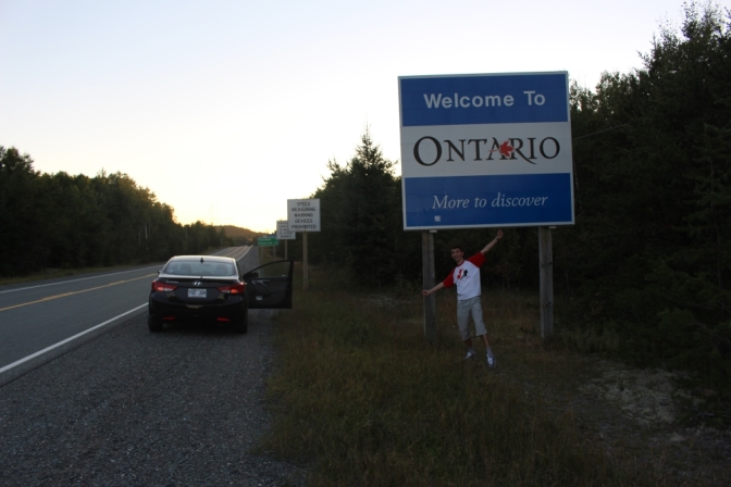
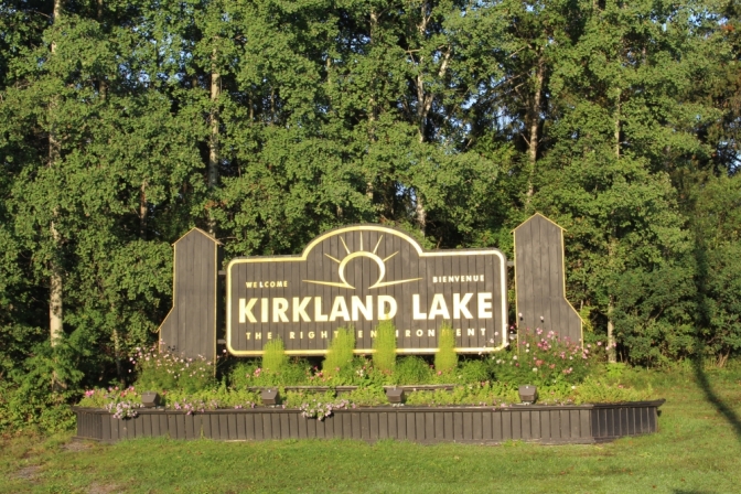
Then there was the first major milestone of my journey – Ontario border. Shortly after that – my first stop for the night at Kirkland Lake.
Day 2. Kirkland Lake – Thunder Bay, 890 km.
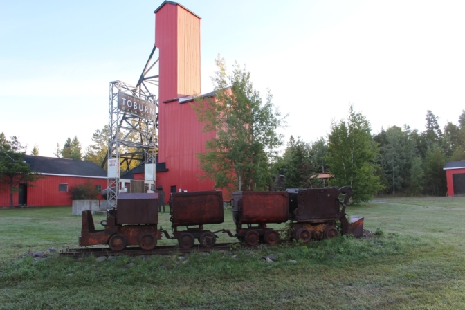
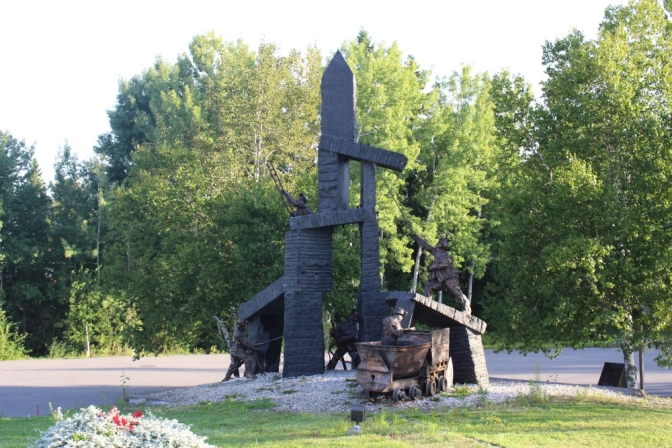
In the morning, I decided to explore the town a little bit before continuing west. It was established in 1919 to mine for gold, but also known for hockey players. The town pays tribute to both its famous features with mining museum and hockey heritage center. There was a long drive ahead of me, so I did not have enough time to pay a visit.
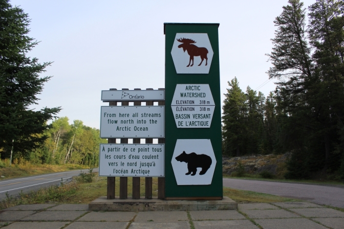
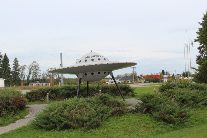
The road goes in North-Western direction into remote areas of Ontario. There are many interesting places to see along the way, like Arctic Watershed, a landed flying saucer and many more!
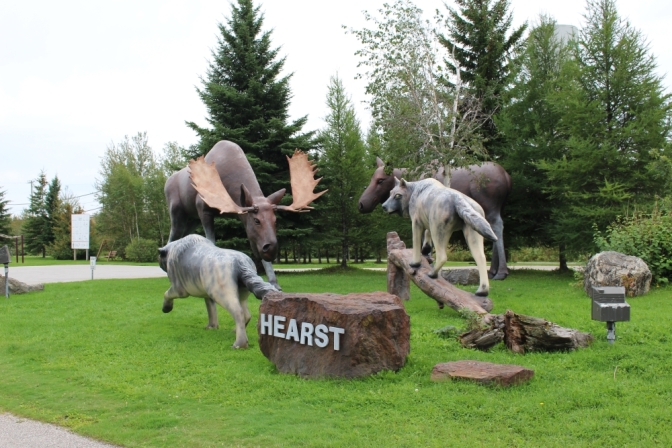
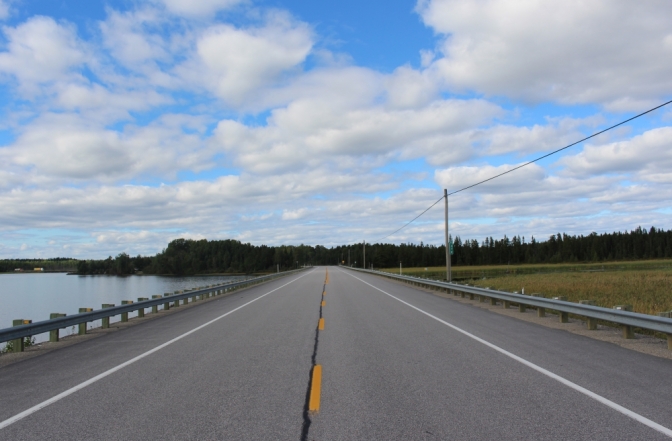
At first road goes through relatively populated area, with towns every 30-40 minutes. But after reaching Hearst, the civilization ends. First, there are 200 km to Longlac, where there is no any house or cell coverage for almost entire section. Then some small villages and another 200 km to Nipigon with very few people in sight. In total, there is about 400 km of remote road, where I have not seen a single gas station and mostly without cell coverage. Make sure you have your tank full before it!
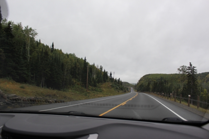
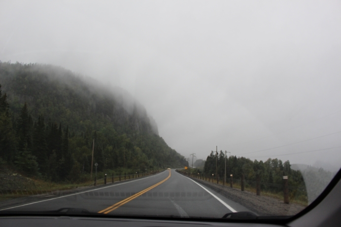
In general, the day’s drive was quite a difficult one, I must admit. It was raining like crazy for most of the trip, and there were a lot of trucks that were fighting to get their heavy loads over hills. Overtaking many trucks on the oncoming lane on a mountainous road in heavy rain is not an easy walk.
The last section of the road before Nipigon goes through mountains, that looked completely out of this planet in a conditions that I had. Heavy rain and fog made mountains disappear or float in clouds. It was amazing view!
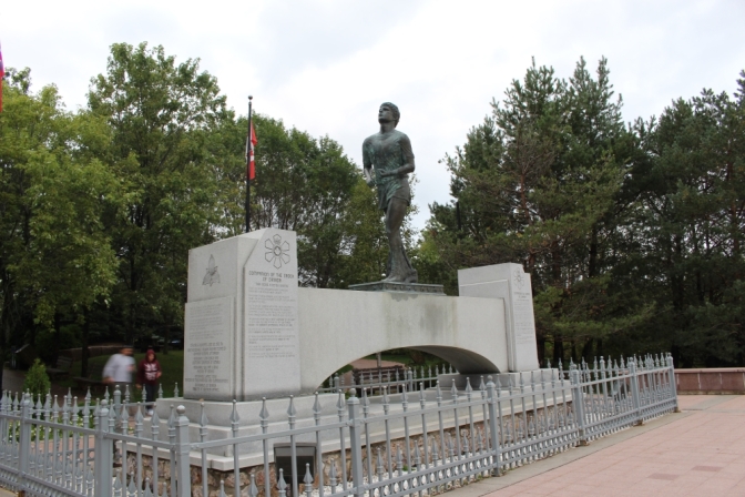
As the evening was approaching, I was approaching my second night stop – this time in Thunder Bay, Ontario. But just before it I had a very special place to see. It was a Terry Fox memorial. It is a place where Terry had to terminate his marathon run across Canada. The memorial is an amazing place to visit, don’t miss it. First, it is a good way to pay tribute to a brave son of Canada, second – it is a very nice park, and finally – the view is just breathtaking! The memorial is located on a top of a rock and it offers splendid view on Thunder Bay and Lake Superior.
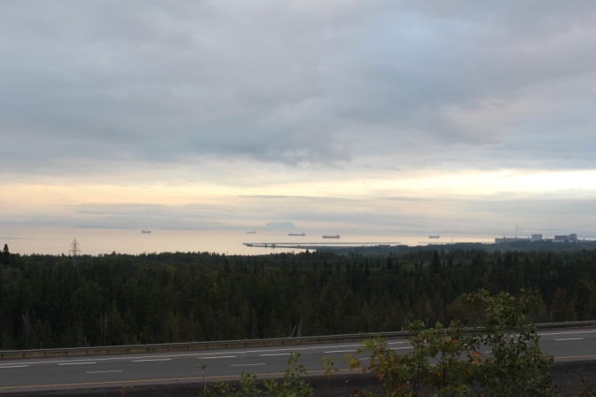
The sunset was beautiful, but most of all I was impressed to see ocean-going ships laying at anchors on Thunder Bay roads. It is easy to understand ships in Montreal, which is far away from the ocean, but where you have a big river. But here, after 2 days of driving through mountains… Canada is amazing!

Bravo Igor, amazing story! I was wondering how you did you find enough time for sightseeing, admiring the nature and taking such nice pictures!
LikeLiked by 1 person
Thanks! I made a list of things I wanted to see en-route and tried to have a rest stops when I reached them.
LikeLike